


GEOINT, IMINT, MASINT and World War I
Read on to learn how fashion photography helped win the war!

The term GEOINT, or Geospatial Intelligence, is defined today by U.S. statute as “the exploitation and analysis of imagery and geospatial information to describe, assess, and visually depict physical features and geographically referenced activities on the earth. GEOINT consists of imagery, imagery intelligence and geospatial information.” Imagery intelligence, or IMINT, is a subset of GEOINT referring to “technical, geographic, and intelligence information derived through the interpretation or analysis of imagery and collateral materials.” Geospatial information is “information that identifies the geographic location and characteristics of natural or constructed features and boundaries on or about the earth and includes (A) data and information derived from, among other things, remote sensing, mapping, and surveying technologies; and (B) mapping, charting, geomatics data, and related products and services.”[1] The Director of the National Geospatial-Intelligence Agency (NGA), within the U.S. Department of Defense, serves as the Functional Manager for GEOINT within the U.S. intelligence community in the same sense that the Director of the CIA serves as the Functional Manager for HUMINT.[2]
The closely related field of MASINT, or Measurement and Signals Intelligence, is “information produced by quantitative and qualitative analysis of physical attributes of targets and events to characterize, locate, and identify them.” Signatures can appear in many forms, including but not limited to chemical, optical, radiofrequency, and acoustic.[3] The Director of the Defense Intelligence Agency (DIA), also under the Department of Defense, serves as the functional manager for MASINT.[4]
These fields all saw significant progress during World War I. For the United States, much of the progress was again made under British or French tutelage, as evidenced by a peculiarity of the U.S. Army that persists even today. Americans in general are notoriously resistant to adoption of the metric system:
A notable exception is the U.S. Army, which measures distance in kilometers (“klicks,” in soldiers’ parlance) without any apparent difficulty.
This practice dates back to a decision made by the General Headquarters of the American Expeditionary Forces (GHQ AEF) in Chaumont, France in 1917. The GHQ’s intelligence section, G-2, had a topographical section designated G-2-C, which was so desperate for maps of the Western Front upon arrival that it had to obtain them directly from the French Service Geographique de l’Armée (SGA) or the British GHQ, in addition to as many commercial maps as they could purchase in Paris. Sometime in late 1917, a board of officers met at GHQ and decided:
“1. To employ the metric system.
2. To adhere to the types and scales of maps in use by the French.
3. To use the French system of designating the location of events by coordinates.”[5]
As the head of G-2-C observed in his post-war report,
“The adoption of the metric system for military maps is recommended. Apart from its manifest advantages from a logistical and mathematical point of view, it has been used by our army during the present war and all our personnel are familiar with it. Our artillery is calibrated in the metric system. It is used by the majority of civilized nations both in commercial and military life, and the greater part of the military documents and maps are in it. The British army was on the point of adopting it at the close of the war, and had only been deterred up to that time by the necessity of recalibrating their artillery range instruments and redrafting their maps. Military topographic instruction should be in the metric system.”[6]
For the U.S. Army, at least, it has been ever since.
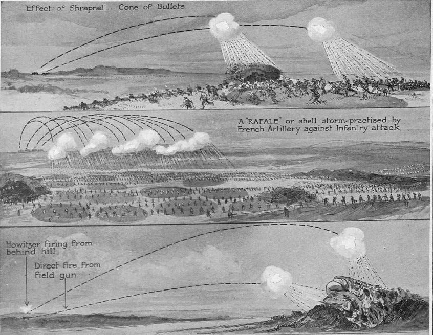
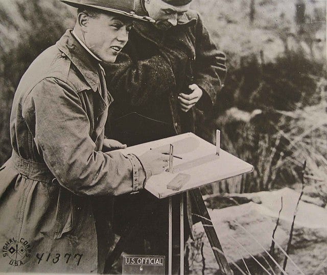
Accuracy of maps was indeed of particular importance given the increased use of artillery on the Western Front—large, long-range guns, howitzers, that could be kept hidden from view with the naked eye and needed to be capable of hitting targets that were also hidden from view. World War I largely inaugurated the particular facet of modern warfare that involves killing people one cannot see. Artillery needed to be capable of inflicting casualties via airborne exploding shrapnel, on opposing forces hidden behind hills and protected by entrenchments. This required more sophisticated land survey skills and the use of surveying instruments for mathematical measurements, typically by individuals with an educational background in engineering. In general, the need for large-scale and accurate maps and surveying equipment for artillery increased “rapidly and continuously” with the advent of trench warfare.[7]
At the outbreak of World War I, the French military had an officers’ corps that, on the whole, was far more proficient than their German or American counterparts, and even somewhat more proficient than the British, at military cartography and land surveying. Why was this? Two late-19th century historical were likely the leading factors: France’s defeat in the 1870 Franco-Prussian War, and the European “Scramble for Africa” of the 1880s and 90s.
As noted in my post two weeks ago,

France’s humiliating defeat by Prussia in 1870, including its painful loss of Alsace-Lorraine, instigated a wholesale revamping of the French military that included the creation of the Deuxieme Bureau and the elevation of the importance of military intelligence. But another French army imperative to restore its lost sense of honor was the continuing expansion into Africa that had started with its invasion of Algeria in 1830 and now included much of West Africa as well.[8] Of the two academies turning out French military officers, the school of Saint-Cyr and the Ecole Polytechnique, the latter emphasized engineering and other more modern, scientific fields, from which graduates could choose either military or civilian careers. If they went the military route, they would typically go into the artillery or military engineering.[9] Either way, they needed to know something about cartography.
Even during the Franco-Prussian War, the French army possessed better maps of Algeria than of eastern France.[10] Military graduates of both schools were often sent out to France’s African colonies, where they sharpened their skills at topographical survey in regions that had never been mapped by Westerners (I have previously discussed the centrality of colonialism to the Westphalian concept of linearly bounded territories here):

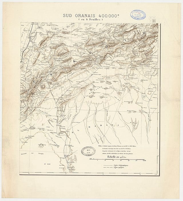
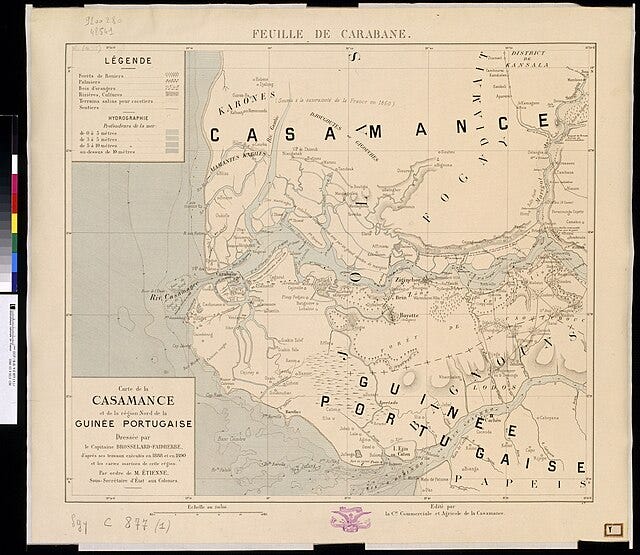
While some officers of the 1870s and 80s considered such “paperwork” to be unworthy of their military valor, others, like Captain Henri Brosselard, embraced the idea of the adventurous “field cartographer.” As a new lieutenant, Brosselard was first sent to Algeria to chart the route of a projected Trans-Saharan railway, collaborating on a 1:200,000 scale map. He was then sent on a topographical exploration mission in French Sudan. He assisted in suppressing an insurrection in Algeria by drawing maps of the region of South Oran. In 1886 he was sent to West Africa, where his mapping skills earned him a spot on the bi-national Border Committee officially determining the divide between Portuguese Guinea and the surrounding French possessions.[11]
Until the turn of the 20th century, virtually all cartographic production in France was controlled by the military, either through the SGA (created by decree in 1887) or the Ministère de la Marine.[12] The French military’s standardization of mapping was also aided by the metric system, which was formally adopted by the French revolutionary government in 1795 and mandated for all French nationals in 1840. Between the SGA and the newer Comité du Service Géographique du Ministère des Colonies (the Committee of the Geographical Service of the Colonial Ministry), created in 1908, France was offering ample professional advancement opportunities for individuals with these highly technical skills in both the military and civilian sectors.
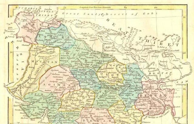
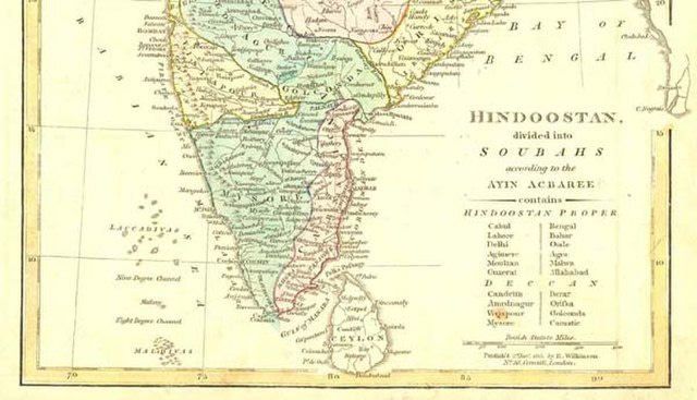
The British, of course, had acquired several centuries’ worth of land mapping experience, as it had been an essential element of their colonization of the Indian sub-continent. In contrast to the French, however, the mapping expertise had developed more organically in civilian scientific and commercial circles, as it was aimed more at taxation and revenue management.[13] Mapping in support of military expeditions, as the French did, tended to focus more on details like village fortifications, the best way to attack villages, granaries and water supplies, and routes that could facilitate troop movements against resistance forces.[14]
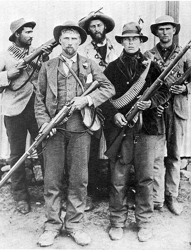
It was not until the Anglo-Boer War in 1900 that the British military was truly taken with the intelligence value of map-making. In most of Britain’s colonial wars up to that point, its superior firepower had “more than compensated for any lack of geographical knowledge of the territory.” In facing the Boers, by contrast, who had modern weaponry, the lack of reliable maps “cost the British forces dearly, and Britain realized that if it wanted to retain political supremacy in large areas of the [African] continent, it would have to make provision for the systematic mapping of its dependencies.”[15]
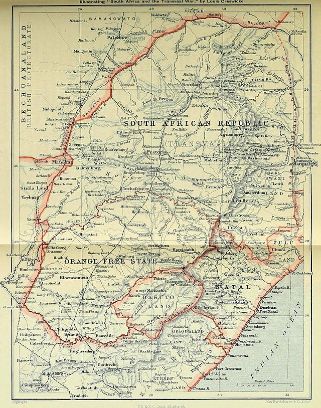
Thus, just as the Boer War prompted the creation of the two intelligence entities known today as MI-5 and MI-6 , it also led to the establishment of the Geographical Section of the General Staff (GSGS), also known as Military Intelligence-4 or MI-4. In 1902, the School of Military Engineering completely overhauled its curriculum regarding land surveying, including use of the plane table, a surveying instrument widely used by the British in India.
In 1913, the British conducted a military survey of Sinai at a scale of 1:125,000, already aware of the potential threat of global conflict to their control of the Suez Canal.[16] The British still needed to catch up to the French, but during World War I, “[t]he great flexibility that British military surveyors displayed…and the high quality and utility of the maps they produced were a consequence of the reforms instituted [at the School of Military Engineering] and the experienced gained in colonial survey work in the decade before the outbreak of war.”[17]
On the Western Front, the British were still heavily reliant on the French for maps of France proper. The French had helpfully developed a common grid system for their maps, very useful for plotting coordinates. As the American Expeditionary Forces (AEF) began arriving in France in 1917, American artillery units
“soon adopted the French technique of indirect fire without adjustment, often called ‘map firing.’ They had perfected a system of ground survey that could be used to tie the firing batteries and targets together on a common grid system. A reconnaissance officer assigned to each battalion, aided by excellent French maps, was responsible for bringing horizonal, vertical, and directional control into each battery position area. A premium was placed on the precise directional orientation of each individual gun or howitzer. Because of variable factors, including non-standard weapons and powder, atmospheric conditions, and differences in projectiles, artillerymen adopted an empirical method of measuring the sum and direction of non-standard effects. By firing a weapon of known location and comparing the firing table values achieved, the sum of non-standard effects could be inferred and expressed as a correction. These corrections, determined and applied in proper ratio, permitted fire without adjustment on other targets. The technique was called ‘registration.’ To aid in registration, the American field artillery used weather data collected by the French and transmitted it to the field through the Artillery Information Service.”[18]
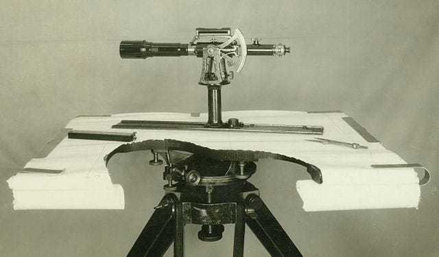
The French and British had also developed two other methods for locating hidden German artillery, based on their signature. The French method was called “flash spotting,” which involved several differently placed observers spotting the “flash” of a particular gun firing (sometimes its reflection against a clouded night sky) and then plotting the point of intersection. The other, which the British preferred and which turned out to be more effective, was called “sound ranging.” This was a similar method of triangulation, but it required a network of microphones.
The basic technology is still used today, including by many U.S. cities that employ acoustic gunshot detection systems such as ShotSpotter to pinpoint the location of gunfire.[19]
The French SIGINT units (discussed in this post):

were among the first to develop radio traffic analysis as a method of locating troops on the move. Before they sent anything to the cryptanalysts, they recorded call-signs, volume of traffic, and correspondence for all stations. The frequency of correspondence in a particular direction could help them determine which was the headquarters unit, whereas the volume of the transmission could differentiate fast-moving cavalry units from infantry units. At first they had to operate on the assumption that the loudness of an intercepted signal roughly indicated the distance of the source of transmission.[20]
The British soon added a more refined method of geolocation, called Direction Finding (D/F) or Angle of Arrival (AOA). Because electromagnetic waves from a radio transmitter travel in a straight line, two AOA antennas that are well separated can determine the location of the transmitter through triangulation; three can locate a target in the air or in space. Shortly after the war, the British began building a number of AOA systems in France. They then set up a chain of stations in England, such that by May 1915 they could track German submarines crossing the North Sea. Later in the war, they could also track Zeppelin dirigibles and German aircraft. The AOA method is still used today, as dramatized in a scene from the 2013 film Zero Dark Thirty.[21]
What the Americans brought with them under Pershing’s leadership was an enthusiasm for aircraft. When the U.S. Army first acquired airplanes around 1907, it was not apparent what they might be good for beyond carrying messages, so they were initially assigned to the Signal Corps. But Pershing was impressed with some of the aviators who served under him during the punitive expedition into Mexico in 1916, so once he was in command of the AEF overseas, he pulled his air service out from under the Signal Corps and created an independent AEF Air Service. It was commanded by Colonel (soon Brigadier General) William “Billy” Mitchell, who had preceded Pershing to France as a military observer.[22] At the time, most Western militaries were still debating the utility of aircraft in warfare. Prior to World War I, only the Italians had gained any operational experience using aircraft in warfare, with their invasion of Libya in 1911.
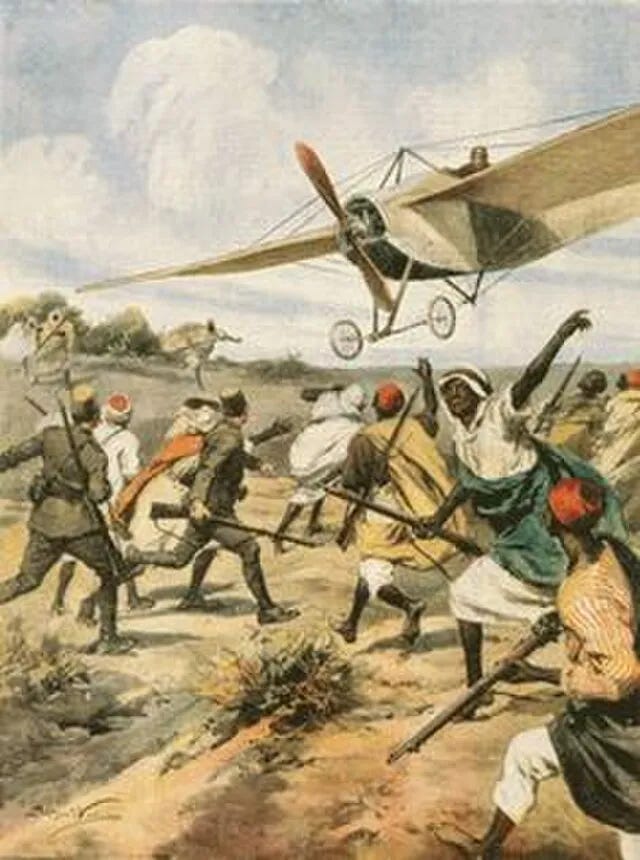
The aircraft of that era had little capacity to carry bombs, and those pilots who argued for combat roles for aircraft represented a small minority of opinion; these were also the pilots who “tended to die young.”[23] But the Germans, French and British had all found them useful for reconnaissance, a role traditionally performed by cavalry in an era of open, mobile warfare that had become untenable for use in the trenches.
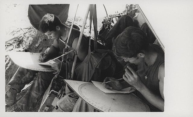
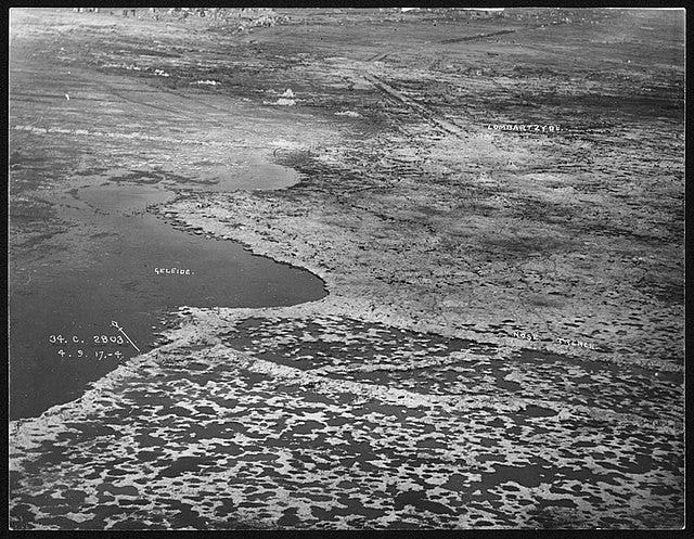
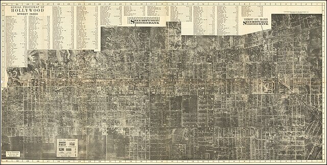
The AEF Air Service’s Observation Corps, which finally began flying their own squadrons in April 1918 after months of operating under French units, flew four kinds of missions. The first was called “artillery réglage,” essentially helping artillery units search for and hit targets. The second was “infantry liaison” to help commanders better control the front lines of battle. The third was the “reconnaissance” or “visual” mission; i.e., flying over enemy lines and simply taking notes. The final type of mission was the photographic reconnaissance mission.[24] It was this fourth type that provided the building blocks of the discipline of IMINT, and also the practice of photogrammetry, which is “the science of making measurements from photographs.”[25]
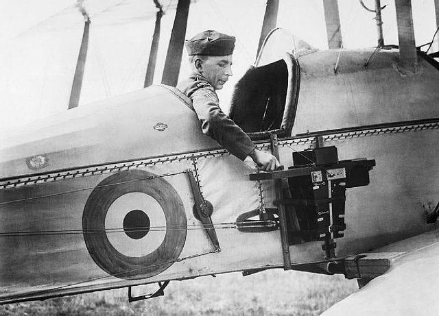
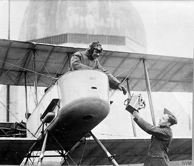
Photogrammetry would first require certain innovations in photography. In the summer of 1917, a single, newly-commissioned Signal Corps officer named James Barnes decided based on some scholarly readings that aircraft-mounted cameras “under trained direction,” backed by “special, trained laboratory forces” that could “quickly, accurately and scientifically” process the information and convey it to field commanders could be a new weapon of war. He pestered the Signal Corps into creating a Photographic Division. Barnes was aided in his efforts by the arrival in the United States of Luxembourgian-American women’s fashion photographer Edward Steichen, who was living in northern France until the German invasion prompted him to flee to the United States, where he was commissioned as a First Lieutenant in July 1917.
British and French experts on aerial photography helped set up a training school for photography specialists in the United States, while Barnes and Steichen deployed to France and joined up with the AEF Air Service.
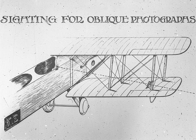
The taking of aerial photographs, however, was not only dangerous (the requirement to obtain a good photograph limited the pilot’s ability to take evasive action), it was only half the challenge. Interpretation of the imagery was the other half.
In 1917, people were still completely unaccustomed to seeing the earth from above. Steichen observed that “the average vertical aerial photographic print is upon first acquaintance as uninteresting and unimpressive a picture as can be imagined. Without considerable experience…it is more difficult to read than a map, for it badly represents nature from an angle we do not know.”[26] A second course was established at Cornell University for photographic interpretation for intelligence purposes, again taught in part by British and French experts.
There was some debate over whether interpretation of photographic imagery was more conducive to artistic temperaments than scientific ones, or whether the French even had certain “racial characteristics” that gave them an edge over Americans. The AEF’s first two photo sections, supporting I Corps and the First Army, were taught in France, by French instructors using a French curriculum, under Steichen’s supervision.[27]
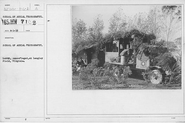
As both sides of the conflict became better at aerial photography, they also developed camouflage, creating a new sort of cat-and-mouse game of intelligence versus counterintelligence. The use of camouflage netting over valuable targets presented a problem until it was discovered that camera filters could reveal the difference between natural and artificial foliage. Once that problem was solved by the photographers, the camoufleurs in response figured out how to create dummy targets, such as fake planes, and place them under camouflage netting while the real planes remained in their hangars. The AEF formed a Camouflage Section, which recruited carpenters, painters, and scenery and property specialists from the theater and motion picture industry.[28]
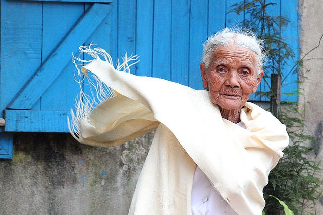
Then photointerpreters discovered that snow, grass and dirt changed in appearance when people walked on them, creating a visible path to a valuable target. Once again, some knowledge of fashion turned out to be helpful: in Madagascar, the fibers used to create the traditional garment known as lamba comes from the raffia palm tree, which can also be used to create matting.
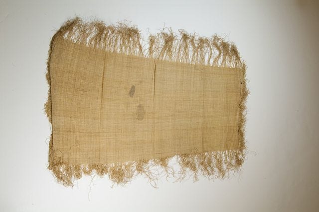
How this came to the attention of AEF camoufleurs is unclear; they may well have encountered French troops from Madagascar, as Madagascar was a French protectorate at the time, and Malagasy troops were fighting in France, Morocco and Syria during World War I. At any rate, the AEF camoufleurs somehow discovered that the matting, when viewed from above, looked like a well-worn path in the dirt. They quickly purchased ten thousand miles’ worth of raffia matting and used it to mislead German photointerpreters.[29]
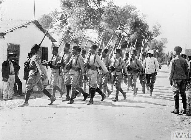
In November 1918, four U.S. Army officers arrived in France with an experimental three-lens camera to conduct tests under wartime conditions. Unfortunately for their scientific endeavor, they were too late for actual hostilities, as the armistice was declared on November 11. The sheer number of U.S. forces arriving in France had decisively shifted the balance in the Allies’ favor in just over a year’s time. Great Britain had long since diverted both troops and mapmakers away from the Western Front and towards its burgeoning Middle East colonial empire, advancing into Palestine in 1917, where Gaza City became the first town mapped entirely by air survey, as it was still behind Turkish lines.
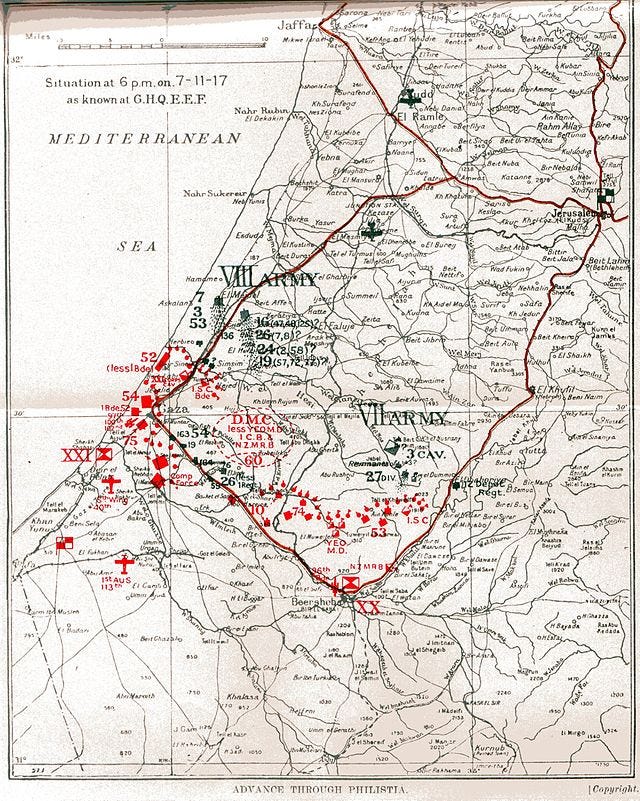
Unlike the Western Front, the war in the east was more open and mobile, which posed certain challenges to the aerial reconnaissance techniques developed for more static trenches.[30] The Third Battle of Gaza, fought in November 1917 between British and Ottoman forces under primarily night conditions, saw significant innovation in the use of rapidly made position maps. The maps were produced every night during the battle and then used as overprints for existing base maps. They were then rapidly dispatched to the troops.[31]

(If you’re surprised or confused about the relevance of Gaza to World War I, then definitely read this):

For the Americans, the innovations continued after the cessation of hostilities. In 1918, Sherman Mills Fairchild received a government contract to develop an improved aerial camera. He experienced a cost overrun of more than five times the contract budget, and by the time the camera was ready, the war was over and the U.S. Government lost all interest. Fortunately for him, his father was George Winthrop Fairchild, chairman of the Computing-Tabulating-Recording Company (soon to be renamed IBM), which was making a fortune selling the tabulation machine that had been invented by Herman Hollerith to compile data for the U.S. Census of 1890 (which I posted about here in my discussion of identity resolution technology):

The elder Fairchild paid the difference on his son’s government contract, and Sherman Mills Fairchild went on to found Fairchild Aerial Surveys in 1921.
The technological advances in aerial photography and photogrammetry continued throughout the interwar period in the U.S. commercial sector, until government interest in the field picked up again with the outbreak of World War II. [32] Such innovations set the United States on a trajectory that has led to it being a world leader today in both aerial (including satellite) surveillance and drone warfare. After World War I, aerial observation became such an accepted part of American war preparedness that many U.S. Army leaders, including Pershing, would go on to oppose the creation of a separate U.S. Air Force because it would endanger their access to this particular form of intelligence.[33]
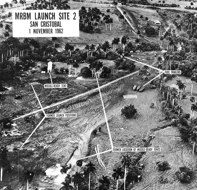
(Remember Cuba? I wrote about it here):

One more legacy of World War I and its innovative methods of raining death from the sky came in the area of medicine. Troops came back from the Western Front with a variety of physical ailments, but there was one in particular that physicians could not easily categorize as either physical, neurological, or entirely psychological. Early sufferers were widely believed to simply be lacking in courage. The condition and its variants go by a number of names and acronyms today, but in World War I, the troops in the trenches had their own name for it: shell shock.
[1] 10 U.S.C. § 467.
[2] National Geospatial Agency, National System for Geospatial Intelligence, Geospatial Intelligence (GEOINT) Basic Doctrine Publication 1-0, September 2006, available at https://irp.fas.org/agency/nga/doctrine.pdf (viewed January 27, 2025), at 4. See also Office of the Director of National Intelligence (ODNI), “What is Intelligence?” at https://www.dni.gov/index.php/what-we-do/what-is-intelligence (viewed January 27, 2025).
[3] R.M. Clark, Geospatial intelligence: Origins and Evolution (Georgetown University Press, 2020), at 102.
[4] See Office of the Director of National Intelligence (ODNI), “What is Intelligence?” at https://www.dni.gov/index.php/what-we-do/what-is-intelligence (viewed January 27, 2025).
[5] Colonel R.G. Alexander, Report of the Assistant Chief of Staff, G-2-C (Topography), GHQ, AEF, in Center of Military History, United States Army, United States Army in the World War 1917-1919, Vol. 13 (Washington, DC, 1991), at 52, available at https://www.history.army.mil/html/books/023/23-19/CMH_Pub_23-19.pdf (viewed January 27, 2025).
[6] Id. at 79.
[7] Ute Schneider, “Maps, Geography and the Representation of Space,” International Encyclopedia of the First World War, last update December 13, 2017, available at https://encyclopedia.1914-1918-online.net/article/maps-geography-and-the-representation-of-space/ (viewed January 29, 2025).
[8] Isabelle Surun, “French military officers and the mapping of West Africa: the case of Captain Brosselard-Faidherbe,” April 2011, Journal of Historical Geography 37(2):167-177, at 168.
[9] Surun, id.
[10] Deborah Susan Bauer, Marianne is Watching: Knowledge, Secrecy, Intelligence and the Origins of the French Surveillance State (1870-1914), Ph.D. thesis, UCLA (2013), at 107, citing Porch, French Secret Services, 23.
[11] Surun, at 171-72.
[12] Axel Baudouin, “Mapping in Colonial Times, La Côte français des Somalis et contrées avoisinantes by Alexandre Meunier (1908-1909), Cybergeo: European Journal of Geography, 2022; Philippe Boulanger, “Military Mapping by France,” in Mark Monmonier, ed., The History of Cartography Volume 6, Cartography in the Twentieth Century, 905, available at https://press.uchicago.edu/books/HOC/HOC_V6/Volume6.html (viewed January 30, 2025).
[13] See generally C.A. Bayly, Empire & Information: Intelligence gathering and social communication in India, 1780-1870 (Cambridge University Press, 1996), at 307-14.
[14] Thomas J. Bassett, “Cartography and empire building in nineteenth-century West Africa,” Geographical Review, July 1994, Vol. 84 Issue 3, p. 316.
[15] Elri Liebenberg, “Military Mapping of Sub-Saharan Africa,” in Mark Monmonier, ed., The History of Cartography Volume 6, Cartography in the Twentieth Century, 894-95, available at https://press.uchicago.edu/books/HOC/HOC_V6/Volume6.html (viewed January 30, 2025).
[16] Peter Collier, “Military Mapping of North Africa,” in Mark Monmonier, ed., The History of Cartography Volume 6, Cartography in the Twentieth Century, 952, available at https://press.uchicago.edu/books/HOC/HOC_V6/Volume6.html (viewed January 31, 2025).
[17] Peter Collier and Mike Nolan, “Military Mapping by Great Britain,” in Mark Monmonier, ed., The History of Cartography Volume 6, Cartography in the Twentieth Century, 895-96, available at https://press.uchicago.edu/books/HOC/HOC_V6/Volume6.html (viewed January 30, 2025).
[18] Janice E. McKenney, “United States Field Artillery in World War I,” in Koninklijke Brill, ed., King of Battle, Artillery in World War I” (Leiden, 2016), at 295-96.
[19] R.M. Clark, Geospatial intelligence: Origins and Evolution (Georgetown University Press, 2020), at 103.
[20] David Kahn, The Code Breakers (The MacMillan Company, 1972), at 300.
[21] R.M. Clark, Geospatial intelligence: Origins and Evolution (Georgetown University Press, 2020), at 95-97.
[22] Mark Stout, World War I and the Foundations of American Intelligence (University Press of Kansas, 2023), at 142, 146.
[23] Stout at 143.
[24] Stout at 147-48.
[25] R.M. Clark, Geospatial intelligence: Origins and Evolution (Georgetown University Press, 2020), at 25.
[26] Stout at 158-59.
[27] Stout at 150-52.
[28] Stout at 160.
[29] Stout at 159-60.
[30] Stout at 163. The AEF aerial reconnaissance efforts faced similar challenges after the Meuse-Argonne Offensive of September 1918 similarly forced the Germans into defensive, dynamic movement.
[31] Peter Collier and Haim Srebro, “Military Mapping of the Middle East,” in Mark Monmonier, ed., The History of Cartography Volume 6, Cartography in the Twentieth Century, 967-68, available at https://press.uchicago.edu/books/HOC/HOC_V6/Volume6.html (viewed January 31, 2025).
[32] R.M. Clark, Geospatial intelligence: Origins and Evolution (Georgetown University Press, 2020), at 26.
[33] Stout at 165.